Magseis Fairfield clinches two OBN seismic projects in Gulf of Mexico
Oslo-listed seismic data acquisition company Magseis Fairfield has secured two deepwater ocean bottom node projects in the U.S. Gulf of Mexico.
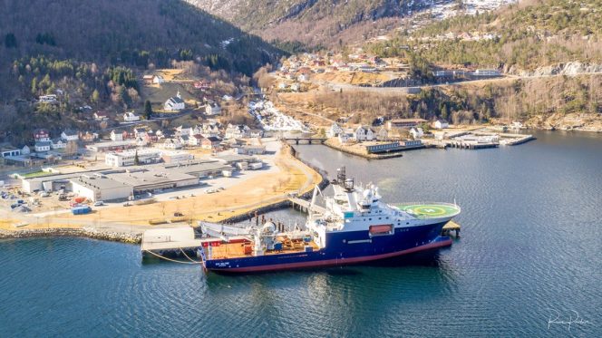
Rem Saltire – Image source: Rem Offshore
The company said Friday it had been awarded two consecutive deepwater ocean bottom node (OBN) projects in the Gulf of Mexico by an undisclosed repeat customer.
The surveys will be carried out in the Mississippi Canyon and Garden Banks areas and will cover a total area of more than 900 square kilometers.
According to Magseis Fairfield, work is scheduled to start in the second quarter of 2020 and is expected to take approximately 100 days.
“The award of these two projects demonstrates our technology leadership position in the Gulf of Mexico. This ZXPLR crew has been in high demand, and the award strengthens our 2020 backlog significantly,” says Carel Hooijkaas, CEO of Magseis Fairfield.
The ZXPLR crew led by the REM Saltire node handling vessel was established in the Spring of 2019 and has since been in continuous demand for projects in the Gulf of Mexico, Magseis Fairfield said. According to the company, this contract extends the project coverage for this crew through August 2020.
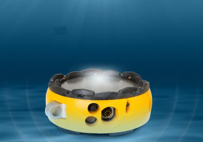
The ZXPLR node, per the company, is a hybrid system capable of dual-mode deployment in both deep and shallow water. According to Magseis Fairfield, it is designed to simplify node management, maintenance, and inventory control, reducing overall costs by supporting multiple operations. ZXPLR can be deployed with a passive rope or by ROV.
Magseis Fairfield ZXPLR node – Image by Magseis Fairfield
TGS expands Argentina survey and adds second Shearwater vessel
Multi-client geoscience data provider TGS has decided to expand the Malvinas 3D multi-client seismic program offshore Argentina. The survey will now employ two Shearwater-owned vessels instead of only one.
Amazon Warrior vessel; Source: Shearwater
Back in September 2019, Shearwater was awarded a large survey in South America. At the time, the name of the client was left unknown. The company said the six-month project would be acquired by the Amazon Warrior vessel.
Later, at the end of October, TGS said it would undertake a new 3D multi-client project in the Malvinas Basin offshore Argentina. TGS said the survey would employ one Shearwater vessel, with operations set to begin in the fourth quarter of 2019 and run until the second quarter of 2020.
In a statement on Wednesday, Shearwater announced an expansion of the previously announced South America survey to two vessels and also confirmed this survey was for TGS in Argentina.
Shearwater added that the additional phase was for five months bringing the total award to 11-vessel months. One of Shearwater’s high capacity seismic vessels will be used for the project, capable of deploying large streamer spreads in tough environments.
“We are very pleased to see a second vessel added to the TGS Argentina program,” said Irene Waage Basili, the CEO of Shearwater GeoServices.
“Market visibility for 2020 has increased significantly and clients are booking capacity earlier than in previous years.”
In a separate statement on Wednesday, TGS said that the Malvinas 3D seismic survey would cover approximately 17,800 square kilometers of the highly prospective Malvinas Basin. This expansion represents a 10,500 square kilometer increase from the previously announced 7,300 square kilometers.
TGS said that the initial products would be available in early 2021, with final products slated for H2 2021. The project is supported by industry funding.
Kristian Johansen, CEO at TGS, commented, “We are delighted to announce the expansion of the Malvinas 3D project. The increased commitment from clients to fund new projects offshore Argentina demonstrates the value that E&Ps place in seismic as a vital tool to make informed drilling decisions.”
The Argentine foreign ministry said last October that three oil companies – Rockhopper, Premier Oil, and Argos Resources – were carrying out oil and gas activities on the continental shelf near the Falkland Islands – without the authorization of the Argentine government.
Argentina said that the oil and gas exploration and production activities being carried out offshore the Falkland Islands constituted “unilateral acts contrary to international law.“
Seabed Geosolutions eyes OBN survey job in Gulf of Mexico
Seabed Geosolutions, a joint venture between Fugro and CGG, has received a letter of intent for another 3D ocean bottom node (OBN) survey in an active area of the U.S. Gulf of Mexico for ‘a major energy company.’
Fugro said on Wednesday that the project would use Seabed Geosolutions’ Hugin Explorer vessel, equipped with CASE Abyss nodes that would be deployed by remotely operated vehicles (ROVs).
The survey, which will be performed in 2,000 meters of water depths, will start in the coming months and take approximately three months to complete. The letter of intent includes an option for another survey.
Stephan Midenet, CEO of Seabed Geosolutions, stated: “We are delighted to again partner with this major energy provider in another deepwater Gulf of Mexico field.
“We are confident that our proprietary OBN technology, coupled with our extensive expertise in the Gulf of Mexico, will aid in illuminating their target field with the data quality they need to meet their development goals.”
TGS begins new 3D survey offshore north-west Africa
Norwegian seismic player TGS has begun a new seismic survey in the Mauritania-Senegal-Guinea-Bissau-Conakry (MSGBC) basin, offshore north-west Africa.
Source: TGS
TGS said on Friday that the Senegal North Ultra-Deep Offshore (SN-UDO-19) 3D survey covers over 5,100 square kilometers, with a modern broadband acquisition set-up.
The project is being undertaken in partnership with GeoPartners using the vessel BGP Prospector and with the support of the Senegalese national oil company Petrosen.
This stand-alone survey is located in northern Senegal and is a continuation of the recently completed SS-UDO-19 3D acquisition in southern Senegal.
The survey has been designed to illuminate plays in the ultra-deep, enabling explorers to build upon the successes of the Sangomar field (formerly known as SNE), the Greater Tortue Ahmeyim complex, and Yakaar discoveries.
According to the company, the project has a 75-day acquisition timeline, with fast track data available three months after the acquisition, in time for evaluation of blocks available in the recently announced Senegal Offshore 2020 License Round. The full dataset will be available by the fourth quarter of 2020.
Kristian Johansen, CEO of TGS, said: “This survey will provide the industry with essential subsurface insight ahead of Senegal’s Offshore License Round, which is scheduled to commence early next year. SN-UDO-19 extends our coverage in a highly prospective region where TGS has been actively acquiring data for almost two years.”
Oil giant Shell has hired Shearwater GeoServices for a seismic acquisition project in the Black Sea.
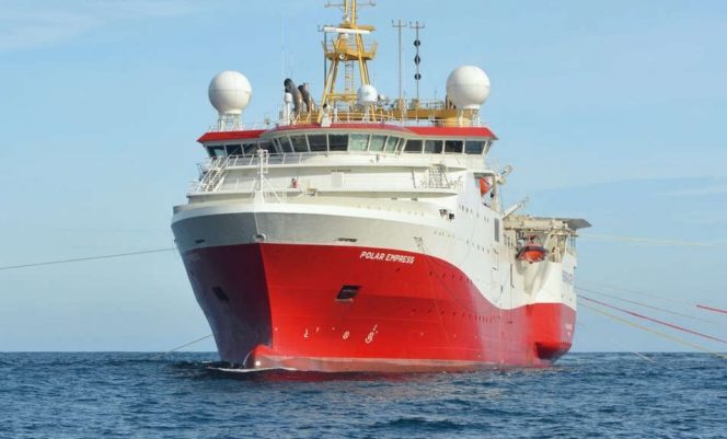
Polar Empress / Source: Shearwater GeoServices
Shearwater said Monday that the survey would cover an area of approximately 600 square kilometers in the western Black Sea.
The project is expected to last one month and will begin in the fourth quarter of 2019. Shearwater will deploy the 2015-built Polar Empress survey vessel for the project.
“We are very pleased to receive this award by Shell which will employ the Polar Empress in continuation of other successful work offshore Turkey this season,” said Irene Waage Basili, the CEO of Shearwater GeoServices.
As previously reported, Turkish TPAO in September awarded Shearwater’s Polar Empress vessel a seismic acquisition and depth processing contract in the Turkish sector of the Black Sea.
Irish government to provide certainty on offshore licenses in first-ever policy paper
Certainty on existing Irish offshore exploration licenses will be set out in the official Government policy paper on the sector, which is scheduled for December.
For illustration: Irish coast; Source: Pixabay
The Irish Offshore Operators’ Association (IOOA) said last week that the timing of the first-ever Government policy paper on the exploration sector in Ireland had been confirmed to the association in writing, together with confirmation that it would contain an acknowledgment of a ‘fundamental duty to protect Ireland’s energy security’.
According to the IOOA, the government says the paper will also acknowledge the security rationale for ‘using indigenous over imported sources in terms of employment, tax yield, and lower carbon impact’.
A commitment has also been provided by the government to ‘address current uncertainties’ and ‘providing greater clarity on what is required of the industry in order to underpin the operation of a robust and effective regulatory regime.’
Responding, Mandy Johnston, CEO of IOOA said: “A policy paper on exploration is a first for Ireland and represents a real effort to end a period of political and regulatory uncertainty.
“As the representative body of the offshore sector, we remain fully engaged with the Government ahead of the publication. We welcome assurances that exploration remains part of the energy mix into the future, including assurances that all applications and authorizations in place will progress as normal through standard lifecycle stages.
“This acknowledgment does bring us forward towards the certainty our sector has been seeking. The policy paper next month is a real opportunity to flesh that out and ensure that offshore resources remain the backbone of Irish energy security and supply, as they have been for over four decades.”
Namely, during the UN Climate Action Summit in September An Taoiseach Leo Varadkar stated the Irish Government’s intention to phase out oil exploration licenses in the future.
Varadkar said that Ireland’s Independent Climate Change Advisory Council had recommended that exploration for oil should end as it is incompatible with a low-carbon future. The Council recommend that exploration for natural gas should continue for now as a transition fuel.
The Government of Ireland then confirmed that the country’s existing exploration licenses would not be affected by the announcement of its plans to end all future oil exploration in the country. Irish offshore oil and gas industry welcomed this clarification, but asked for further clarity on how the new government’s proposal for future licensing rounds would be implemented.
The IOOA on November 12 received further clarification on the country’s existing licences.
On that occasion the government confirmed that all future licensing rounds in the currently closed area offshore (Atlantic Margin – 80%) would be for natural gas only and not oil.
The government also confirmed that all new license applications in the currently open area (Celtic Sea, Irish Sea, coastal areas – 20%) would be for natural gas only and not oil, applicable from the day of the Taoiseach and Minister Bruton’s announcement on September 23, 2019.
The government also confirmed that all applications and authorizations in place before the announcement was made would not be affected by the decision.
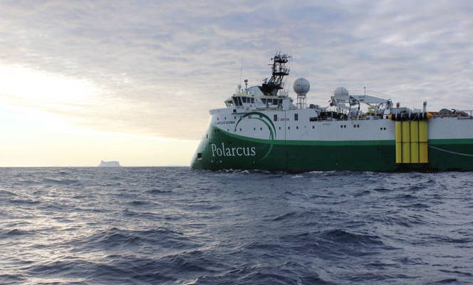
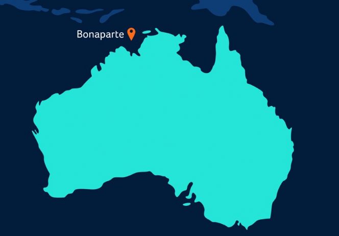
Polarcus begins seismic surveys over Neptune’s field offshore Australia
Seismic services provider Polarcus has begun seismic surveys in the Neptune Energy-operated Petrel field, located in the Bonaparte Basin offshore Australia, which is the first substantial investment in Petrel for five years.
Polarcus Asima seismic vessel; Source: Polarcus
Neptune said on Wednesday that the study would expand the area of seismic data the company holds and significantly increase the quality and breadth of data to allow Neptune and its partners to plan for the future.
Neptune, on behalf of the Petrel JV, has entered into a non-exclusive data licensing agreement with Polarcus, which is acquiring the Petrelex 3D seismic survey.
Neptune Energy Australia Managing Director, Janet Hann, said: “The Bonaparte Basin presents exciting growth opportunities for Neptune, and Petrel may play a significant role in our future aspirations for the area. We look forward to working closely with our partners as we deepen our knowledge of Petrel in order to define the potential for further development.”
Polarcus secured approval for an Environmental Plan allowing acquisition of new 3D multi-client data to be acquired across the field.
The Polarcus Asima vessel began the campaign on November 30 and will continue into late January 2020, subject to operational conditions, covering 2,900 Km2 of territory. Data from the survey will be available in the fourth quarter of 2020.
Neptune holds 54% of the project and alongside its partners Santos (40.25%) and Beach Energy (5.75%) is investing in new broadband technology over an expanded area in order to get a better understanding of the significant potential resources that Petrel holds.
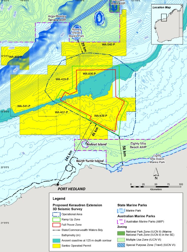
Santos files plan for new seismic survey offshore Australia
Australia’s Santos has submitted an environment plan for the Keraudren Extension 3D Marine Seismic Survey located offshore Australia and the plan is now open for comment.
Keraudren Extension 3D Marine Seismic Survey map
According to an update by Australia’s offshore regulator NOPSEMA, Santos proposed to undertake a 3D seismic marine survey over a portion of exploration permit areas WA-435-P, WA-436-P, WA-437-P, and WA-438-P, and surrounding waters in the Bedout Sub-basin in Commonwealth waters off the coast of Western Australia.
At its closest point, the survey Operational Area is located approximately 45 kilometers (km) from the nearest land (Bedout Island), 56 km from the nearest mainland coastline and 141 km from the nearest regional town Port Hedland.
The survey data is required to develop regional geologic models to inform the exploration permit retention strategy, and the potential location of future drilling of exploration and development wells.
Seismic acquisition will be via methods and procedures similar to other seismic surveys conducted in Australian waters. The seismic survey vessel will travel along a series of pre-determined lines towing cables, which contain microphones. As the survey vessel travels along the lines, sound waves will be directed down through the water and into the geology below the seabed. The sound that reflects back is measured by the hydrophones and is later processed to provide information about the structure and composition of geological formations below the seabed.
The survey may be acquired in stages. The exact area to be acquired in each stage will be determined based on operational and timing factors, and in consultation with key stakeholders. To allow for flexibility a period of three years, between 2020 to 2022, is proposed in which to complete the survey. It is Santos’ intention to start the survey in 2020 and to acquire the full survey within two of the three years.
In order to avoid sensitive fish spawning and whale migration periods, the acquisition of the survey will only be undertaken between February 1 to July 31 in any given year. The first phase of acquisition is unlikely to start before April 2020.
The survey will take at least 132 days to complete, with operations occurring on a 24-hour basis. An additional 30 days of contingency time within the operational area has been provided as part of the environmental assessment.
The survey Operational Area defines the area within which the seismic survey and support vessels will operate and is approximately 20,160 km2. Water depths across the Operational Area range from about 40 m to 250 m.
The Survey Area is comprised of the Ramp-up Zone and Full Power Zone. The Full Power Zone is the area within which the seismic source will be operated in full acquisition mode to achieve the geophysical objectives of the survey. This zone is approximately 8,620 km2, with water depths ranging from 40 m to 168 m.
The Ramp-up Zone is a zone that surrounds the full power zone. Typically, this zone will be used to incrementally build the power of the seismic source from non-operation to full capacity, for the purpose of soft starts. This zone is approximately 2,610 km2, with water depths ranging from about 40 m to 185 m.
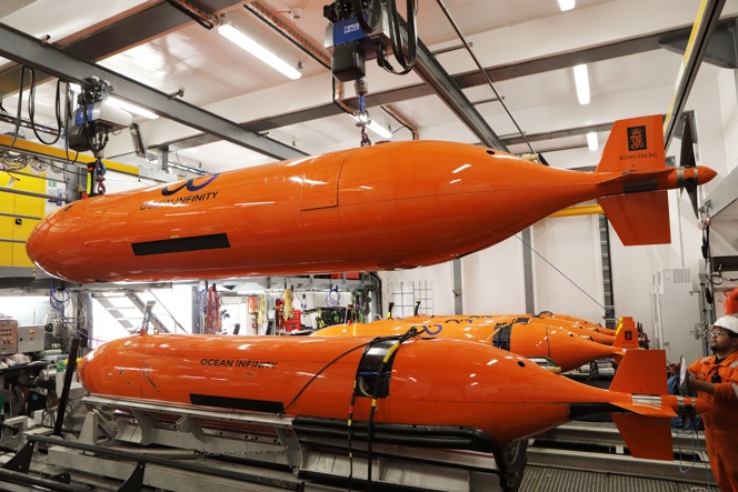
Total hires Ocean Infinity for seismic surveys in Angola
Source: Ocean Infinity
Subsea technology and data company Ocean Infinity has been awarded a contract by Total for seismic surveys in Angola.
During the project, Ocean Infinity will be deploying its technology to conduct 2D ultra high-resolution seismic surveys and seabed soil sampling in Block 32 and Block 17.
Paul Helmore, Ocean Infinity’s CCO, said: “We are delighted to be supporting Total E&P in Angola with this project and that our ability to provide answers for the offshore energy sector continues to be recognized.
“Being awarded this project further confirms that our innovative technology driven approach is continuing to meet the growing demand for a higher value and lower impact method to acquire ocean data. We are excited to be working with Total on this project to gather data in the most innovative way the industry has seen.”
Total first moved into Block 17 in 1997. Located off the coast of Angola, nearly 1,300 meters below sea level, Block 17 is made up of four major hubs – Girassol, Dalia, Pazflor and CLOV (Cravo, Lirio, Orquidea and Violeta) – which were gradually brought on stream between 2001 and 2014.
The Block 32 contains the Kaombo project, which is located 260 kilometers off the coast of Luanda, in water depths ranging from 1,400 to 2,000 meters.
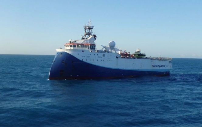
Seismic operations underway over Total’s block in South Africa
New marine seismic acquisition programs over the Total-operated Block 11B/12B offshore South Africa have started.
SW Cook; Source: Shearwater
Total is the operator and has a 45% interest in Block 11B/12B, while Qatar Petroleum and Canadian Natural Resources Limited have 25% and 20% interest, respectively. Africa Energy holds 49% of the shares in Main Street 1549 Proprietary Limited, which has a 10% participating interest in the blocks.
In an update on Tuesday, Africa Energy said that the 2D seismic program had started. The 3D seismic survey is expected to begin later this month.
Garrett Soden, Africa Energy’s President and CEO, commented, “Seismic operations will continue through April 2020 alongside the next drilling campaign, which is expected to begin in the first quarter of 2020 with the spud of the Luiperd well. The joint venture plans to keep the rig on Block 11B/12B for almost a year and drill up to three exploration wells. We congratulate the operator, Total, for expediting this ambitious exploration program, and we look forward to rig mobilization in January.”
Shearwater GeoServices is acquiring an initial program of 3,650 linear kilometers of 2D seismic using the multi-purpose vessel SW Cook with fast-track processing onboard. The 2D seismic program will attempt to define the lead and prospect inventory of the large under-explored area in Block 11B/12B to the east of the Paddavissie prospects.
Petroleum Geo-Services (PGS) is acquiring 2,200 square kilometers of 3D seismic using the PGS Apollo seismic vessel. In this second phase of 3D seismic work on the block, the joint venture plans to cover the remainder of the Paddavissie Fairway to better delineate the prospects and leads identified on the previous 2D and 3D data.
In March and April 2019, Polarcus Limited acquired 570 square kilometers of 3D seismic using the Polarcus Asima vessel. The first phase of 3D seismic covered the Brulpadda discovery and the Luiperd prospect. The joint venture received the preliminary, fast-track 3D results in August 2019, and the fully processed 3D seismic dataset is by January 2020. The preliminary 3D results validated the direct hydrocarbon indicators and thick reservoir development, confirming the large resource potential of the Paddavissie Fairway.
Block 11B/12B is located in the Outeniqua Basin 175 kilometers off the southern coast of South Africa. The block covers an area of approximately 19,000 square kilometers with water depths ranging from 200 to 1,800 meters. The Paddavissie Fairway in the southwest corner of the block includes the Brulpadda oil and gas discovery, as well as several large submarine fan prospects that have been significantly de-risked by the discovery and subsequent 3D seismic work.